Habitat mapping
Work continued on mapping the marine habitats of the study sites through the analysis of aerial and satellite images.
Several types of algorithmic treatments have been applied to the hyperspectral and Lidar aerial data which have allowed the development of relevant indicators based on slope, slope variation, roughness or bottom concavity. They were grouped together in a turtle index corresponding to the identification of areas potentially favourable to marine turtles.
This work was carried out on the island of Europa for the "pIOT" pilot project and on the other Scattered Islands for the IOT project. The next step will be to complete this work by adding recent satellite images and to apply this work on the other study sites.
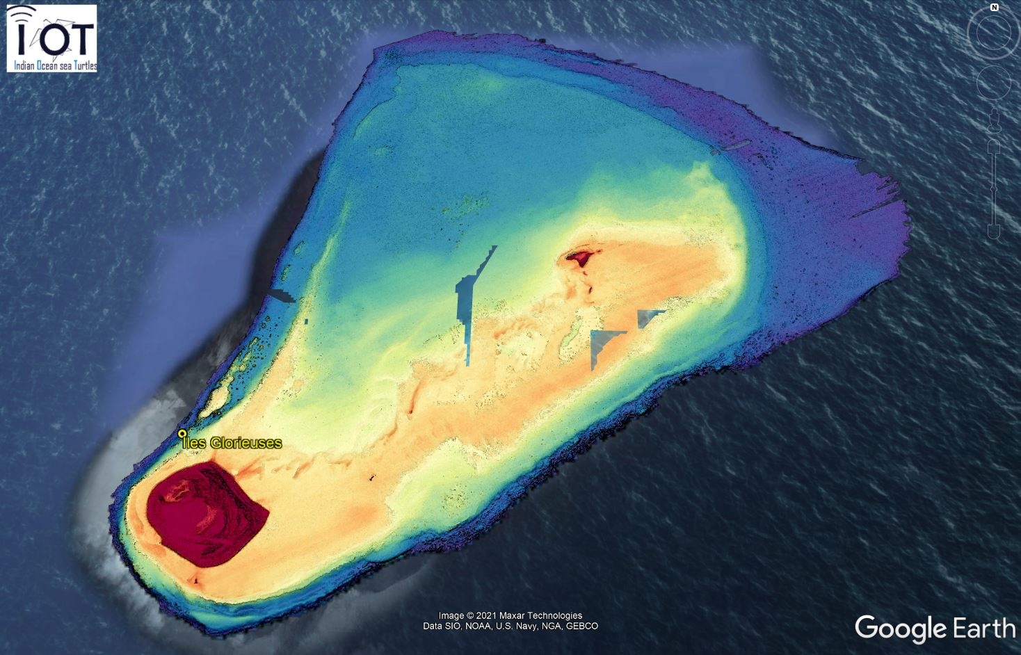
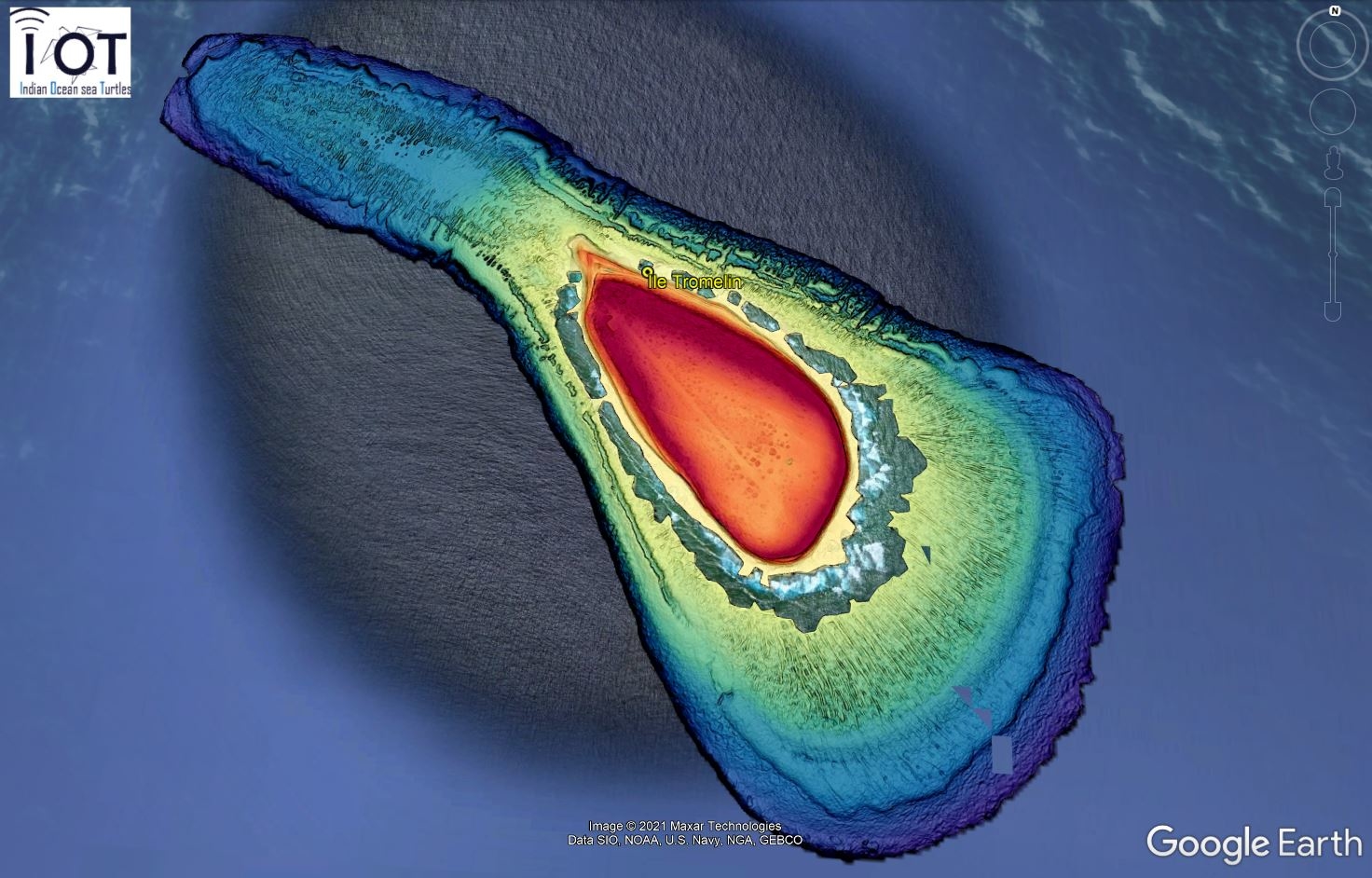
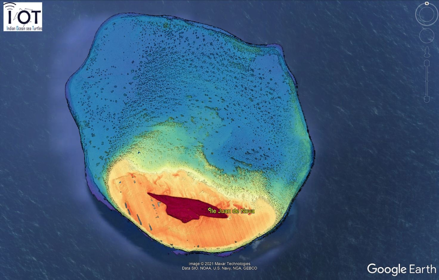
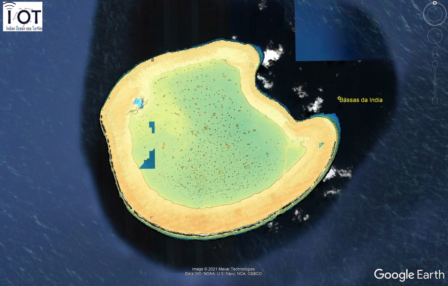
Fine bottom topography thanks to the merging of bathymetry and slope (PEMNTES) for the Scattered Islands - IOT project © Pascal MOUQUET